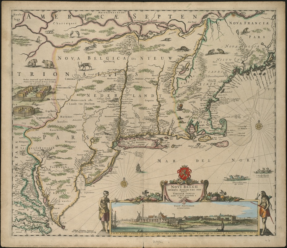
Here’s something Xopher found a few years ago: a Dutch map of Nieuw Belgium from 1682:

(The words that follow are his.)
There are two fronts of exploration shown here, both based on water. One is from the south, the other from the Northeast. From the south one finds the Hudson and Connecticut rivers; from the Northeast, the Saint Lawrence and its tributaries.
The year was 1682; the Marine chronometer would not be invented for another eighty years. Distances east and west could only be estimated by travel times. And it’s a long, long way from Cape Cod to the mouth of the Saint Lawrence.
The result is that the bounds of Vermont, the Connecticut River and Lake Champlain, are both shown on the map, but *in the wrong order*. From this we can conclude that no European explorers had yet journeyed between the two.
If you had said that you had come from a land east of Meer de Irocoisen and west of the Versche Rivier, people would say, there is no such place!